Thursday, May 7, 2015

Bob revisits Raton and Cimarron, NM

May 2nd, 2015. Shortly after getting back on Route 40 heading out of Amarillo we began to see what turned out to be windmills up ahead. Once we got up to where the windmills started we drove another 25 miles to Vega, TX where we left the highway for route 385. At our exit the three rows of windmills were still stretching out down route 40. This has to be one of the largest wind farms going. Local literature says this plain has the most steady winds in the country. The scope of this operation surprised us.
At Dalhart, TX we turned onto Route 87 for the drive into Raton, NM. About 25 miles east of Raton we saw signs for the Capulin Volcano National Monument. It was early so we decided to check it out. There was a road nearly to the top of the volcano. At the top there is a one mile loop trail around the rim and a 1/4 mile trail down into the core. We trekked both. This volcano has been inactive for 30,00 years. The experience was very interesting. Looking across the surrounding plains from above we learned all of the many small peaks had once been volcanoes. The flat-topped buttes visible through out the area were the result of lava from many volcanoes being pushed up to form the buttes. Next we were off to Raton and a stop at the railyard and the White House Inn. In 2000 Bob had traveled with our sons and the Bristol Vt Boy Scout Troop by train from Rutland, VT to Raton, NM. They were then bused to Cimarron, NM and the Philmont National Boy Scout Ranch. They did an eleven day, 50+ mile wilderness trek. It was one of the greatest experiences of Bob's Life. Upon their return to Raton by bus, in the early afternoon, the troop was distressed to learn that the train would be late. It had not yet left California! They spent 12 to 15 hours sitting around the station in their scout travel uniforms. Neil Lindblad (the scout leader) and Bob looked longingly just up the street at the White House Inn. An obviously popular local watering hole. Dutifully they could not partake at that time. Today was to be Bob's day to stop in for a thirst quencher. The train station was there in all it's glory but alas the bar owner sold his liquor license about a year ago. The bar was closed to the public. (A private party was being held to watch the Kentucky Derby, but we didn't join them.) Nursing his disappointment we headed to Cimarron. We stopped in at the St. James Hotel. Their famous past customers included Jesse James, Bat Masterson, Buffalo Bill Cody, Annie Oakley, and Clay Allsion. Wyatt Earp and his brother Morgan and their wives stayed here 3 nights on their fateful journey in 1880 from Dodge City to Tombstone. We took a self guided tour of the amazingly preserved historic hotel and went into the beautiful bar room about 10 minutes before the start of the Kentucky Derby. This stop turned into an excellent consolation prize. Bob drove me down to the Philmont Ranch for a look around.
Finally we headed out of town on Route 64 West. Just up in Cimarron Canyon we found a large pull off without a "No Overnight Parking" sign. After our long busy day we spent a quiet night in the Canyon next to a babbling brook. (Just a little further up the road was available campgrounds not marked on our map).

Heading towards New Mexico

With the motorcycle safely stored in Dave's garage until our return in July, we were heading off to Santa Fe. We knew we were facing 2 or 3 long days of driving. Our goal was to make good time but to avoid highway driving at 70 MPH the entire way. We headed west out of Fort Payne on Route 35 for about 40 miles. Crossing over the Tennessee River into Scottsboro we saw the twin stacks from a nuclear plant producing electricity. Here we picked up Route 72. This was a beautiful, lightly traveled, mostly 4 lane divided highway with a 60/65 MPH limit.
In Huntsville we passed by large rockets and a space camp. They produce many of the rockets used by NASA. Route 72 was clear sailing across Alabama and all the way through Mississippi too.
On the western end of MS we headed north a few miles skirting Memphis, TN and jumping onto Interstate Route 40. Route 40 brought us through Arkansas, Oklahoma and beyond Amarillo, TX. Around 7:00 PM we were heading through Russellville, AR only 80 miles from Oklahoma. We decided it was the perfect place to stop for the night. CrackerBarrel had a restaurant just off the highway. They generally have long spaces for RV's in the back and allow overnight parking. We had a very quiet restful night in their lot.
In the morning it was back on Route 40 heading to Oklahoma City (OKC) I found a reference to a historical marker for the Chisholm Trail just west of the city center. It was off Garth Brooks Blvd. We decided to combine a little sight-seeing with a gas stop. It was a reminder of what a wild and untamed area this was just over 100 years ago. The trail crossing was at the site of an important watering hole (Cowboy Camp Springs) used by drovers as they passed through this area on the way to the railheads in Kansas. Created by the confluence of two natural springs, it had been used for hundreds of years by Indians, buffalo and other wildlife. The pure, clean water made a perfect location for Cowboy campsites, the cattle themselves were watered nearby on the North Canadian River just to the north. We stopped in Amarillo, TX at another CrackerBarrel Campground. We had an early evening meal and another quiet restful night.

A great day in Fort Payne

Dave and Maureen Hoyt were so welcoming! Maureen had a feast for Tuesday evening. Today we headed out for some local sight-seeing. We visited a beautiful spot on the river at Little Canyon Falls National Preserve with gorgeous waterfalls and a nature learning center. Maureen may have let it slip that Dave may be interested in a volunteer position. Armed with all the paperwork he will ever need, Dave was eventually released by the head recruiter.
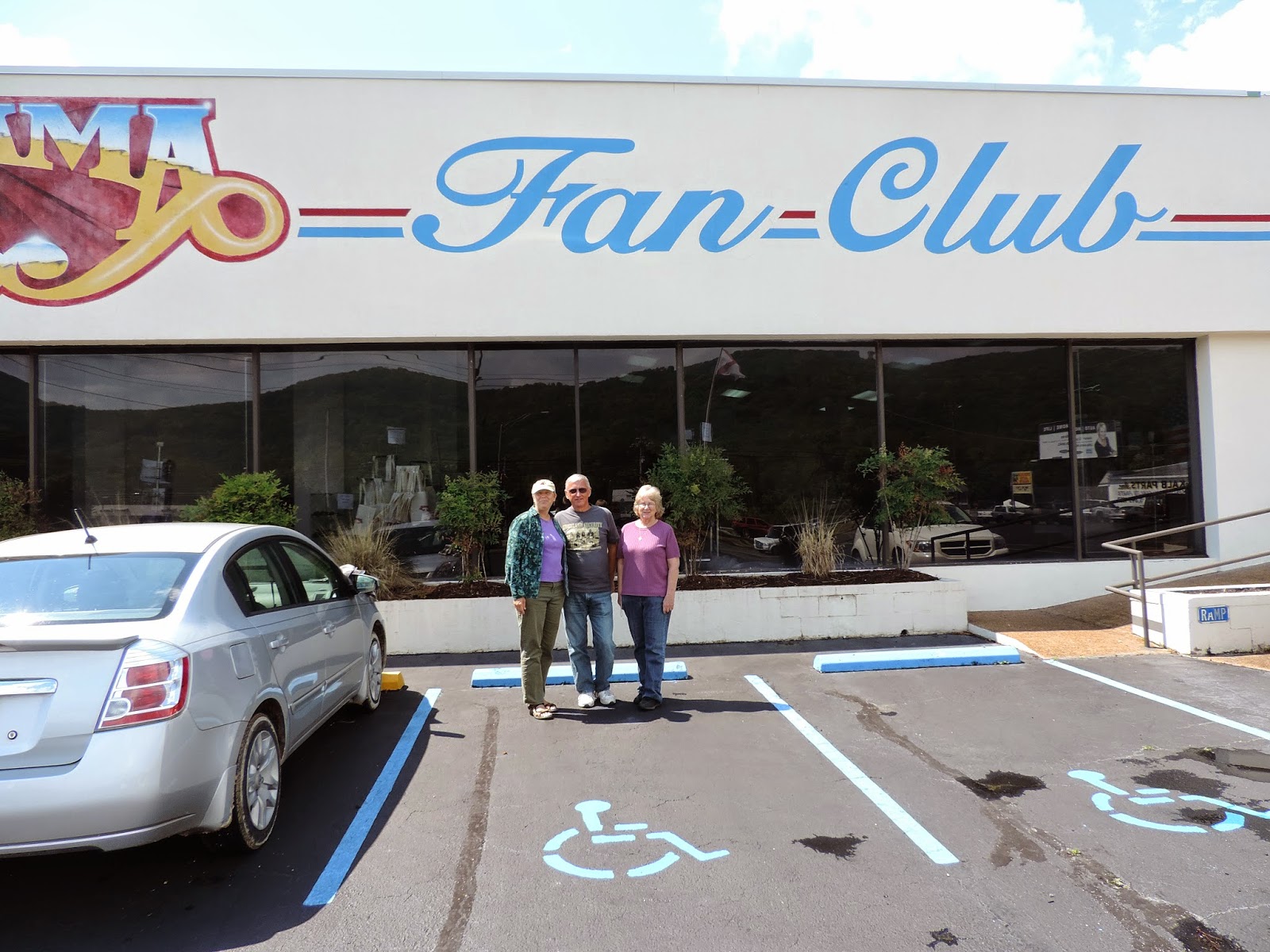
We headed into Fort Payne to check out one of my favorite musical groups, "Alabama". We visited their place of honor in the town park and their Fan Club Museum. Three of the group's members hail from the Fort Payne area, the fourth is from Springfield, MA of all places! Who would have known.
Things then got serious as we visited several historical sites commemorating the "Trail of Tears". Fort Payne was the eastern point in Alabama where the 800 mile forced march to Oklahoma began for the Cherokee Indians of the area.
Our tour ended with a ride through the surrounding beautiful mountains. It was the perfect finish to a fun filled afternoon.

On the road again!

Monday April 27th we began our seasonal trek. It was delayed by a day so Bob could have a dental appt. At noon Bob had a new crown and in a half hour called me to set off. He would catch up along the way on the motorcycle.
He had just weeded his cactus garden and hopes it will flourish while we are away. Our neighbor Bernie's cactus has started blooming. They are beautiful with large pale yellow fragrant blooms. He says they will bloom for a month now. I'm glad we got to see them before we departed. Sherry had wanted to see them too.
Phase I of our trip was getting the motorcycle to Fort Payne, AL and having a quality visit with Dave and Maureen Hoyt. It was a beautiful sunny day. The past 2 weeks temps in Stuart were in the 90's and made packing up and closing up the house a bit sticky, but with Chip and Sherry's help everything fell into place. So with several hours to go before the rain showers (and predicted large hail) would hit we were off. Bob caught up with me as we approached Okeechobee. The lovebugs were raining on our vehicles as soon as we approached the Lake. I was glad I had a windshield! We hit some slow going on Route 60 before we finally headed North on Route 75 in Tampa. Traffic was light and travel easy until about 6:00 pm. That is when the showers hit. Bob stopped for a rain jacket but skipped the pants. The shower wasn't as short and light as the clouds appeared. By 7:30 pm Bob's legs were soaked. It was getting dark so we decided to stop and get a motel in Alachua just north of Gainesville. This was about 100 miles short of where he had wanted to stop. It would make for a longer day of travel for the next day. On April 28th, well rested and dry we headed out around 8:00 am. Bob had on warm and waterproof clothing and the two small showers we hit in the first hour were no match for added gear. In Tifton, GA we exited Route 75 and headed NW on Route 82 to Columbus, Ga. There we crossed the Chattahoochee River into Alabama and followed Route 431 North. We jumped on HWY 59 For the Last 50 miles to Fort Payne and arrived before 5:00 pm with sprinkles occasionally letting Bob know not to dilly dally! As a side note: Two days hence we found out that Bob's credit card had been compromised by a card reader at his first gas stop not 125 miles from Stuart. So much for racking up points for gas purchases on our rewards card.

Monday, August 25, 2014

Superior Lake Superior!

August 24th, 2014 Today we awoke to the sound of rain pouring down and thunder. We got a slower start than we would have liked, but the rains abated and we were on our way by 9:15 AM.
We made our way towards Duluth MN. We crossed the John A. Blatnik Bridge over the lower corner of Lake Superior connecting Minnesota to Wisconsin. This is a very scenic route and we are thinking about planning a return visit to this area some day. The road is in pretty good shape and traffic remains light. It is a Sunday and we hope to get close to if not cross the MacKinac Bridge separating Lake Michigan and Lake Huron by tonight or early morning tomorrow.
Ambitious for such a late start. The road is posted at 55 mph in Michigan, which we feel is reasonable. At the Apostle Islands National Lakeshore NP and area visitors center we had a lengthy stop. It was quite interesting and gave a great history of this area. I read up on the wreck of The Edmund Fitzgerald which occurred just off shore in this region in 1974. Do you remember Gordon Lightfoot's song describing this tragic event? I especially enjoyed the wall murals. I think the young man hiking in the "present day" era portion is a striking resemblance to Paul! Also there were many other displays and a tower to climb (with an elevator) to view the surrounding area. I could see a lighthouse in the hazy distance. It was 82 degrees and you could feel a strong breeze off Lake Superior. About 25 miles north of here is Bayfield, Wisconsin where the NP office is situated. The temps dropped to 77 degrees for most of the afternoon, most likely due to those large lake breezes.
Continuing on Route 2 East we had to be careful with one detour when crossing into Michigan. The road was closed in that portion only the visitors center was open. Fortunately the detour was well marked. And then again further along we were surprised when we dipped back into Wisconsin for about 10 miles. Neither of us ever imagined we'd be traveling this far north in the Central Mid-West States. By 6:30 PM we crossed into our final time zone change back to Eastern! When the sun was getting low we missed a turn in Escanaba, MI. But is was a short diversion that led us to Squaw Point Lighthouse and Boathouse on the shores of Lake Michigan. We were back on track in short time. We finally stopped at 10:30 PM at the Lake Michigan campsite in the Hiawatha National Forest. That is about 30 miles from the MacKinac Bridge. We covered 500 miles and needed a good rest.

Sunday, August 24, 2014

Shale Oil Fracking to Paul Bunyan and Babe!

August 23rd, 2014 We slept OK, except for 3-4 AM. The rain and wind were quite loud. Also a "local" diesel pickup with loud pipes seemed to be cruising the area. We got up at 7 AM. Bob went inside for coffee. One large cup and one medium was 75 cents! Total for both! The price stunned Bob but the cashier assured him it was correct. We finished breakfast and were off at 8 AM.
It was raining most of the morning. We had 50 more miles in Montana before crossing the N. Dakota line. For about the last 20 miles of MT and until Minot, ND we were in the oil shale fracking boom areas. About the only slowdown due to the building boom was in Williston. The entirety of Rte 2 in ND was divided Hwy.
The state coffers must love the boom. Many people have found a way to make money Bob is sure. Especially large property owners along the highway. The farm fields remained mostly Durham Wheat with a few corn, sunflowers or soy beans here and there. The recent rains were putting a hamper on harvesting. There were very tidy drilling/fracking operations of an acre or so interspersed along the fields.
R.V. Parks, Apartment houses and what may have been company provided "man camps" were plentiful. Some housing looked more like construction trailers. Others were like mini quanset huts. Bob supposed for locals and younger imports it would be a good place to work and save for a few years and move on when things slow down. Locals left out of the boom must not be too happy. Many must be earning more than they ever thought possible.
Our first surprise of the day was in Rugby, N.D. There was a monument in the town declaring it the "Center Point of North America." Who are we to argue. I got pictures For the most part N.D. was not very picturesque. Bob was happy to move into Minn. As soon as we crossed the border things seemed to get greener. The gentleman that Bob met in Polebridge who gave us the book on Key West was from Bemidji, MN. Route 2 passes right through town. He told us about the Paul Bunyan and Babe the Blue Ox statues. We went there for pictures.
Richard G., Bob's old route 1 postal carrier had brought everyone back a key chain from there years ago as well. Our 2nd surprise was just down the road from the Paul Bunyon parking lot. We crossed a short bridge over a small river. It was the Mississippi at its beginning headwaters our of Lake Bemidji. We drove on to Grand Rapids for another free night at Camp Wal-Mart.

Going-to-the-Sun Road!

August 22nd, 2014 A wonderful final full day in Montana. We were up around 7:30 am and headed over to the Merc for those wonderful bear claws and were not disappointed. Absolutely delicious. They will be missed.
Next we were off to "the Going-to-the-Sun Road". What a spectacular drive! Even with the clouds the scenery was spectacular. This is the most impressive drive we have ever taken through incredible mountains. We were totally in awe! The max width for vehicles is 8 feet and we are 7'10" so Bob had to be extra cautious, pulled in his mirror! Max length is 21 feet. We may have exceeded that. (The Alaska Marine Hwy man did measure us at that!)
Near the middle we looked down upon a colorful rainbow in the mist in the glacial valley below. The east end was nearly totally in the clouds. We descended to the East Glacier Visitor Center and made our lunch. One mile later we were off to Route 2 east. We will follow that cross-country highway if the road continues to be in excellent shape. As we began over the high hilltops we came upon Black Angus cattle grazing along the road. A sign had warned that they were free ranging. One was standing broadside at a blind curve in our lane. We had to remain on high alert. A short distance further we came up to a group of 7 or 8 horses that were crossing the road. One black stallion on the right decided to join the mares in front of us.
We continued on to Poplar, MT after driving 500+ miles for the day. We slept at a Cenex gas station along Route 2 in Indian Territory.