Saturday, June 6, 2015
Lake Tahoe Area
Sunday, May 31st through Sunday, June 7th, 2014. Leaving Silver Lake Campground and heading East on Route 88 to the junction of Route 89 West up towards South Lake Tahoe, we arrived there just in time for me to attend my Sunday meeting at the Kingdom Hall. Such welcoming people here! After the meeting we continued along the lake and passed Camp Richardson where there was a Renaissance Festival.
We encountered lots of cars parked in any off road area they could find all along the lake as everyone gets out to enjoy the great weather and scenic area. And this is a "shoulder season" when school is just about out for the summer. We are told it gets far more congested in two more weeks through the summer.
There are several State Parks along the route. After 30 miles we reached Tahoe City and took the left turn to continue up 89. About 5 miles more at the traffic light we turned left on Squaw Valley Rd, with the large Olympic Welcoming signs on both sides of the entrance road, each with the Olympic flames burning in front. The 1960 Winter Olympics were held here. A couple of miles more and we reached Squaw Valley Village and Olympic Village Inn where we spent the whole week relaxing in the lush green gardens. We unpacked and settled into a suite for the week. There were a few activities at the Inn in which we participated in. Early morning water Aerobics (just me and 5 others), Biking down the maintained bike paths, Exercise Room, swimming pool and spa. The hike we'd planned up Shirley Canyon was canceled due to threats of a Thunder-storm.
On Tuesday evening I was able to meet at the Tahoe City Kingdom hall too and got to feel their excitement after having their 3 day regional assembly this past weekend!
On Wednesday we headed up to Truckee to have our truck oil changed and we found a car wash too, since we had taken the camper off. We did a good hike down to the historic downtown area while the work was being done. Lunch at Best Pies was tasty too! Then we headed to the west side of town to the Donner Lake State Park. (Remember the Donner Party?) They held their Grand Opening of the Memorial on Saturday, but we checked it out now. It was astounding that the winter of 1846 (I believe) there was such record snow and the Donner Party had so many things go terribly wrong. We watched a documentary at the Inn also and saw the large memorial statue attesting to their hardships. It's base is 22 feet high so the drifting snows may not cover it. That was the depths of the snow pack than encased the emigrants as they tried to make it over the Sierra Nevada range. They were stuck here at this site for the entire winter. Only half survived.
Thursday was a contemplative day with occasional showers though we were productive in the exercise room. Friday we headed down to Tahoe City for our 3 1/2 hour lunch cruise to Emerald Bay and back. The forecast was for stray afternoon thunderstorms. There was a party of 26 with reservations for the boat too, but they did not show up on time so we sailed without them. Seven of us in total! The boat usually holds up to 120 so we had our pick of seats topside, inside or outside,or back out of the prevailing easterly winds (usually it's westerly!)
The views were lovely and the sky remained relatively clear the entire trip. The Captain gave a descriptive overview as we traveled to Emerald Bay. The entire property here was eventually bought up by a wealthy woman. She even built a stone tea house on top of the only island in the bay. (It's also the only island on the whole lake!) The water took on hues of greens especially in this bay and cobalt and many different blues throughout the whole lake! The bedrock is volcanic rock and there are no sediments to cloud the waters, this attributes to the colorful clarity. On the return voyage we sat topside with the 2 other couples while Josii the teenage grand-daughter of one, piloted our vessel with the Captain standing beside her. She was all smiles!
From there we went to the Tahoe City Brewery and tasted their sampler. We both thought the Oatmeal Stout was their best brew. I had beer batter fish and chips while Bob had a tasty Cuban with pulled pork and ham and a special hot sauce they created.
Saturday we completely repacked the truck and camper and got everything ready to go for our check out on Sunday. The plan is to drive up to Truckee to Route 80, then Route 50 all across Nevada. Hoping to find a site at one of the Federal forest campsites near Ely.
"Going Places With Smiling Faces!"
Route 49 through Gold Rush Country
Saturday, May 30th, 2014. We broke camp early and headed back south from Hetch Hetchy area back down to Route 120, then West winding through the mountains clinging to the road as it ribboned it's way down in elevation. We Picked up Route 49 in Mocassin and headed north through several small towns. As we traveled along we could see evidence in the very low levels of the reservoirs of California's great drought and scarcity of water.
In Jackson we continued a couple of miles on 49 to Sutter Creek to visit the town where John Sutter discovered Gold back in 1849. Then we headed back (South) to Jackson pick up Route 88 North/East.
Near Pioneer we took a side road past Indian Grinding Rock to Black Chasm Cavern, a National Natural Landmark which receives no Federal Funding. Hence about $15 per person charge for a nice guided tour down into the caverns. They have the best helectite crystal display in the west, which when we finally reached that "room" my camera battery exhausted. I couldn't run up to the truck for the spare, darn! Interestingly we were told almost no bats or birds come into these caves as they are too cool, and there were only two "animals" that live here. A vegetarian arachnid, (of which I could not remember the names) and a type of zoo-plankton in the water both eating plant like fungi, either on the rocks or in the water.
From there we returned back up the road to Indian Grinding Rock State Historic Park. It sits in open meadow with large valley oaks that once provided Native Americans with an ample supply of acorns. This 135 acre park preserves a great outcropping of marbleized limestone with 1,185 mortar holes-the largest collection of bedrock mortars anywhere in North America. Chaw'se is the Miwok word for the mortar cups that formed in the stone slab as the Miwok people pounded acorns and other seed into meal. The largest chaw'se example can be seen at the park. The main grinding rock also features 363 petroglyphs including circles, animal and human tracks and wavy lines. Some of these carvings are thought to be as old as 2,000 to 3,000 years old; they are now becoming difficult to see. There were other exhibits illustrating what life might have been like for these natives.
Alas we headed up Route 88 as far as we could for the day and found a lovely campsite on the north side of Silver Lake. Here is where I found a few striking red blooms emerging right out of the soil at the base of sequoias. They were almost 12 inches tall. They are called "Snow-Plants" and feed on the fungi of the sequoias roots. Amazing!
"Going Places With Smiling Faces!"
Friday, June 5, 2015
Mammoth Lake Region and Yosemite
Thursday, May 28th, 2015. We drove down from the White Mountains elevations of 8,200 feet to the valley floor and rejoined Route 395 heading North. We stopped in Bishop just a few days after their annual Mule Days. (Parades and rodeo events with mules honoring their historic past.) We stopped at Erick Schat's Bakkery. A Dutch Bakery that produces amazing breads and pastries. We purchased a few tasty items including a loaf of Sierra Nevada Mule Bread, a cross between Original Sheepherder, Sourdough, Crushed Wheat and Honi Squaw Breads. It was delicious. And the chocolate croissant we shared wasn't bad either!
A small park across the street, next to the Information Center, was another lush green oasis in this area. There was a very large Olympic size swimming pool for the community and a local swim team as well as play spaces for children beside a cool stream. Several ducks were also enjoying the clear waters here.
From there we headed up to the town of Mammoth Lakes stopping at their Welcome Center/ranger station. A Ranger there noticed Bob's Polebridge Montana T-Shirt and we struck up a conversation. She was raised there! It brought back pleasant memories.
She tipped us where to go in town for our banking and groceries. After lunch in the parking lot we headed over to Earthquake Fault. It's actually a fissure created by steaming magma about 700 years ago. (young geologically) Then we drove past Mammoth Mountain Ski Area and up to Minaret Vista for lovely mountain views. We are here just before the summer season begins and did not have to use the mandatory shuttle buses. (there is an exemption for campers and we were going to camp near the end of the road at Reds Meadows.)
Continuing on we re-entered National Park Lands and using our pass again, climbed through the mountain passes on very narrow roads paralleling Ansel Adams Wilderness lands to Devil's Postpile National Monument. Devil's Postpile is a unique geologic feature, formed by an eruption of basalt lava. This particular lava flow was ideal for column formation: It was thick with consistent mineral composition, and it cooled slowly and evenly, As the lava cooled it contracted and split into the symmetrical, vertical, hexagonal columns that constitute Devils Postpile. Fire and Ice, a glacial event occurred some 20,000 to 12,000 years ago as the ice overrode the fractured mass of lava. The moving ice carved away one side of the postpile, exposing a sheer wall of columns 60 feet high. Erosion and earthquakes later felled many columns that now lie fragmented on the talus slope below the postpile.
We hiked out to the site following an easy trail along a swift flowing stream. It was very re-energizing. Then we continued about a mile more down the road to Reds Meadows Campground. Another quiet night.
In the morning we awoke to 37 degrees and decided as we were going to drive out anyways, why not look for a nice hot breakfast and bottomless cups of coffee. We backtracked on Route 203 towards Mammoth Lakes(the town) and diverted north on Mammoth scenic loop road to June Lake.
At June Lake Junction we found what we were looking for and had a relaxed breakfast, then with cell phone signal available in the parking lot caught up with family a bit before heading north to Mono Lakes area. In 15 mile or so turned left on Route 120 toward Tuolumne Meadows.
The visitor center there just opened today, but the large campgrounds did not. Still too wet due to snow melts. A few of the smaller campgrounds were going to possible open tomorrow, but we instead drove through the north section of the park and hoped to find a site below Hetch Hetchy. The best overlook is at Olstead Point. Lovely vistas exposing the north view of Half Dome and other rugged large granite mountains. We actually exited the park north of Hodgdon Meadow then turned right off of Route 120 north on Evergreen Road. About 2 miles before reaching the small town of Mather, we secured a campsite at Dimond-O Campground. On National park lands (half price camping again) and took 1/2 of a double site. (there were only two sites left!) Then we headed out to the north to Hetch Hetchy.
Just a few miles north of Mather we re-entered Yosemite and the ranger there had to measure our width. Exactly 8 feet wide. Which is their cut-off. He did allow us to travel in up to the dam/reservoir but gave stern warnings to keep inside the narrow lane and avoid the overhanging rocks at the road sides.
There was a lot of history surrounding this reservoir and O'Shaughnessy Dam. There are two waterfalls on the opposite shore, one of which was barely wetting the rocks at this time of year, but the other lower one Wapama was flowing powerfully. John Muir and other preservationists had wished the valley remained untouched. But in 1906, an earthquake and fire devastated San Francisco, adding urgency and public sympathy to the search for an adequate water supply. Legislation was passed and after a time construction was completed in 1923. The final phase of raising the height of the dam was completed in 1938. Today the 117 Billion gallon reservoir supplies pristine drinking water to 2.4 million Bay Area residents and industrial users. It also supplies hydro-electric power generated by two plants downstream. The reservoir is 8 miles long and is the largest single body of water within the national park. After walking the top of the dam (you could also continue on through the tunnel in the mountain on the other side to several trails including to the bases of both waterfalls.) We headed back to our campsite for the night. After we had eaten our supper another couple also shared our (double) campsite for the night. We were all glad to find a safe and quiet place.
"Going Places With Smiling Faces!"
Thursday, June 4, 2015
Wednesday, May 27th we awoke to another beautiful day. We broke camp and headed up Route 395 North and stopped just 2 miles north of Independence at Mt. Whitney Historic Fish Hatchery. It's building, constructed in 1916 is a beautiful and unique structure with hand-laid stone walls and hand-hewn timbers which houses an interpretive center focusing on wildlife of the Eastern Sierra. (It was closed on this day, unfortunately.) But just being able to walk the lovely grounds and around the serenely shaded pond and observe the large fish looking for a snack. As we departed and headed the shortway down the dirt road back to Route 395 we came up behind a small herd of steer being driven to another pasture. We stayed back and slowly approached until the riders gave us the go-ahead to pass on.
The next stop was at the junction of 395 and 168. An interpretive sign there encouraged us to head up the 27 miles into the Inyo National Forest to the Bristlecone Pines.
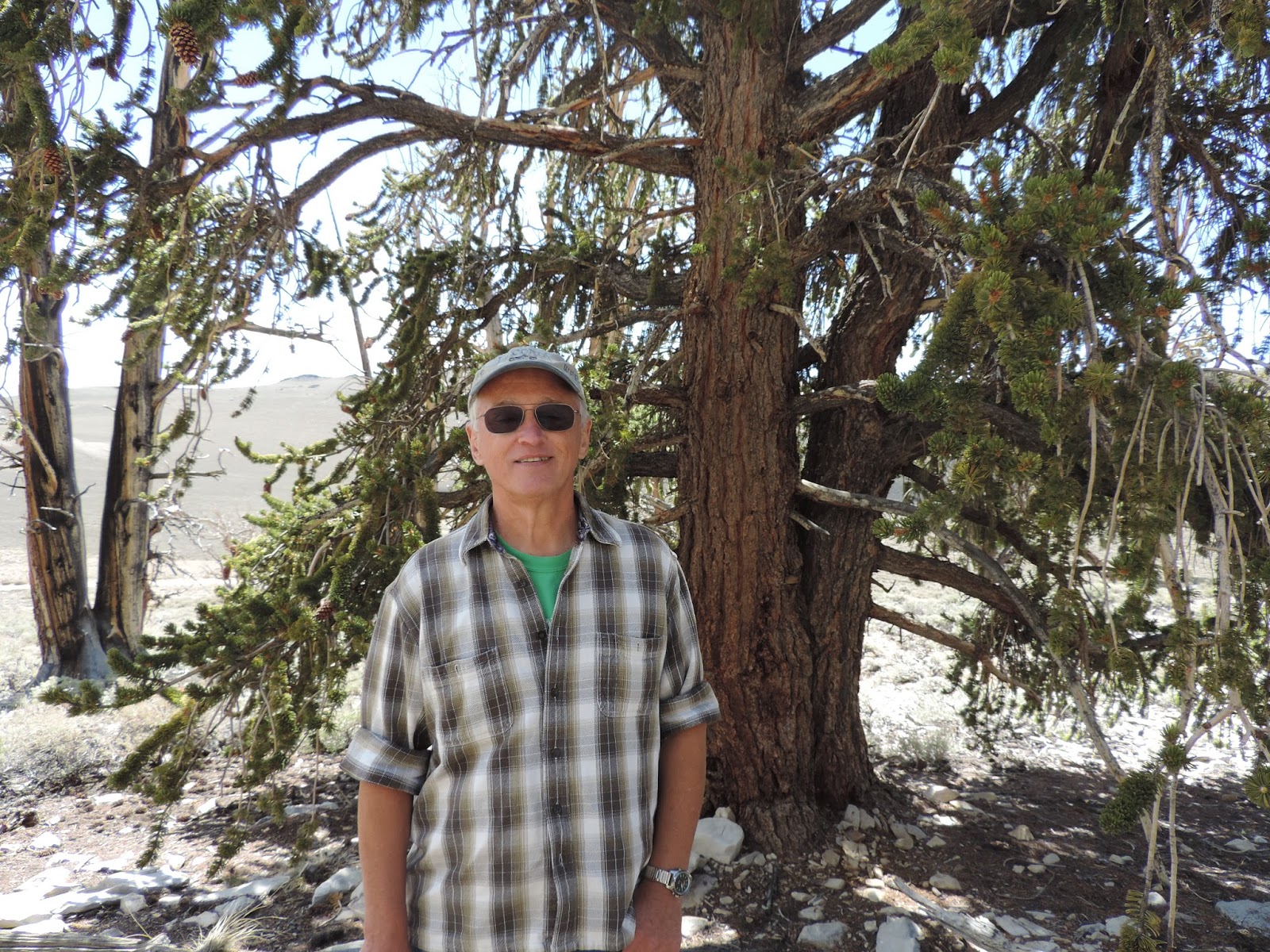
To the east of the Owens Valley stand the Inyo and White mountain ranges. The White Mtns are a typical Great Basin range characterized by a great rock mass of uninterrupted material that has been thrust upward to over 14,000 feet. White Mountain Peak is the thrid-highest peak in CA at 14,246 feet, shorter than Mt Whitney (that we slept in the shadows of) by a mere 248 feet. This range differs greatly from the Sierra range both in structure and climate. It's climate is arid desert and is seemingly an unlikely place to find the oldest living trees, the Bristlecone Pines. The Bristlecones have survived for more than 40 centuries, exceeding the oldest giant seuoia by 1,500 years. Their great age has attracted world-wide interest. Tree ring chronologies, dating back to 6,700 B.C., are used in a variety of research programs, including the reconstruction of climatic history, measurement of past isotope concentrations in the atmosphere, and calibration of the radio-carbon time scale. These trees have been sculpted by wind, ice and extreme exposure to the elements. Their contorted shapes seem to defy nature. We walked a trail slowly and enjoyed this natural sculpture garden. As evening approached we descended a few miles to 8,200 feet elevation and made camp in Grandview CG and watched as the sky was painted by rays from the setting sun. Another peaceful night.
"Going Places With Smiling Faces!"
From the Desert to the Big Valley
On May 26th, we left Mesquite Springs campground and headed back out to the main road in Death Valley. We headed 5 miles north past the unmanned ranger station at Grapevine and drove into the Ubehebe Crater area. It is the remains of an ancient volcano. Just a few hundred years ago a massive volcanic explosion caused by magma mixing with an underground spring, shattered the silence of northern Death Valley. When the cinders and dust settled, this 600 foot deep crater remained. Despite the craters and elaborate erosion we could hike along the rim and see several other craters. The only wildlife we saw were a pair of ravens watching us.
We retraced out driving route out south on Scotty's Castle Road and stopped at Stovepipe Well. We drove into the site of the historic well. This waterhole is the only one in the sand dune area of Death Valley. And was at the junction of two Indian trails. During the mining phase of valley history, when sand obscured the spot, a length of stovepipe was inserted as a marker. Hence it's unique name.
We then picked up Route 190 west and began the long ascent out through Paramint Springs and out of the National Park. We split off onto route 136 and headed up to Lone Pine to begin a journey up Route 395 North.
Lone Pine had lots of interesting stops to check out. Our first stop was at the road junction and the Eastern Sierra Interagency Visitor's Center.
We got updated information on what public lands camping areas were open and headed to our first tourist spot.
Bob especially loved Lone Pine Film History Museum. It showcased memorabilia from over 650 movies filmed in the area. We saw a 15 minute short film that showcased movie clips from over 400 films made right here in the Museum's Back Lot- the iconic Alabama Hills. Bob especially loved the old Westerns. Roy, Gene, Hoppy, the "Duke" are but a few great film and TV series heroes that are honored in exhibits through photos, costumes, props, scripts and priceless movie posters.
From there we headed up into town and stopped at the Bonanza Restaurant, for a tasty Mexican lunch.
We then headed to Manzanar National Historic Site. In 1942, the United States government ordered more than 110,000 men, women and children to leave their homes and detained them in remote, military-style camps. Manzanar War Relocation Center was one of 10 camps where Japanese American Citizens and resident Japanese aliens were confined during WWII.
It was enlightening to see and hear their personal stories.
Established as a National Historic Site in 1992, Manzanar also tells the stories of Owens Valley Paiute life, the homesteading era, and the fruit-growing community of Manzanar.
From there we didn't have to travel but a few more miles downtown to the Eastern California Museum in Independence, CA. It showcased "fancy" and "utilitarian" baskets, arrowheads, beadwork and ceremonial dress housed in the Anna and OK Kelley Gallery of Native American Life. There were exhibits here too of the Japanese Americans in the Manzanar encampment, frontier and ranch farm life exhibits, gems and minerals, and the hydro projects built to bring water down to the highly populated Los Angeles. We closed the place at 5 pm sharp and headed uphill just into the mountains. Camp was at Lower Gray Meadows along a babbling stream. A signpost near the site reminded us to be on watch for rattlesnakes. The snow capped Sierra Nevada range above us made for a nice cool night.
"Going Places with Smiling Faces!"
Wednesday, June 3, 2015
Death Valley
Monday, May 25th. The morning was cooler (in the 80's) and we headed out to see what we could in the desert.
Our first stop was just a couple miles north at the Harmony Borax Works Interpretive Trail. Do you remember the Mule Team Borax soap box commercials on TV growing up? Borax is a white mineral in some alkaline salt deposits, naturally occurring by the repeated evaporation of seasonal lakes. It is used in making glass and ceramics and as an antiseptic. (used in laundry cleaning)
The Borax was refined right here in Death Valley! The Harmony Borax operation became famous through the use of 20 mule teams that moved borax from Death Valley to nearby communities.
Next we stopped in at Salt Creek's Interpretive Trail and were surprised to find pupfish! I imagined Death Valley to be an arid wasteland devoid of life. I did not expect to find a stream flowing in the valley floor more than 200 feet below sea level. Like all desert oases, plants and animals congregate around its life-giving water. This creek gets its start in brackish waters more than a mile upstream. Here, the water becomes increasingly salty due to evaporation as it flows downstream until it is more saline than seawater. The flow varies with the seasons. In winter rains add to the amounts from the spring and the creek stretches out for a couple of miles warming in the sun. As the water warms and food becomes more abundant the pupfish begin mating. We were able to observe this from the boardwalk.
Many were swimming in water just barely a few inches deep. They are very rare and only 8 species exist today. Most all live for only a year or two. They manage to have enough survivors to keep the population functioning. We were able to walk the boardwalk trail which follows the stream. I saw a zebra-tailed lizard in the shrubs along the edges and I was also surprised to hear first, then spot a hummingbird flit among the spring blooms.
From there we drove up to Historic Scotty's Castle. It was claimed by a prospector to be his own elaborate Spanish-style mansion. Built by gold from his fictitious mine. In reality, it was his wealthy friends. Today, living history tours of the castle's richly furnished interior are given by costumed park rangers. There was an oasis here as well with palm trees and it proved a great place to lay in the cool grass and take a short refreshing nap awaiting our tour to begin.
Then we headed to Mesquite Springs campground to stake out any site we liked. There was only one tent pitched in the area. This campground is a bit cooler due to being at a higher elevation of 1800 feet. It is open all year when several of the others close due to the extreme heat. On July 10th, 1913 Death Valley recorded the world's hottest at 134 degrees.
We chilled out relaxing in the evening air and watched for wildlife to come out. A black tailed Jack Rabbit was fun to watch. Another quiet night in the desert.
"Going places with smiling faces!"
Westward through the deserts
On Saturday, May 23rd we packed up camp and hit the road heading out on a long travel day. We began with Route 89A heading up and over Jerome twisting and climbing the mountain. The houses were perched precariously on the steep hillsides on both sides of the road. Going down the backside towards Prescott was even longer and windier. Bob wished he was riding the motorcycle, I reckoned it to be much like "Tail of the Dragon" but the hairpin turns were curved just a bit wider, thankfully for the weighed down RV. The route is not advised if your rig is over 40 feet in length. It was very scenic, on the backside we spotted several large saguaro cacti. Several of these cacti had large white blooms on the tips of their very high tops and I could not get a photo of a blossoms from the road.
We descended through Merrit Pass at 3400 feet. In Aguila we reached route 60-West and just before Quartzite picked up Route 10 West. Another 20 miles and we crossed over the Colorado River (which carved the Grand Canyon further north) and entered California. Gas prices jumped as expected to $4.00 and even over $5.00 a gal. We gassed up at our last chance at the Chiraco Summit exit. There will be no more opportunities until we reach the other side of the Joshua Tree NP.
Upon reaching the visitor's center we learned that there were no campsites available (first come first serve and Memorial Day weekend). We were told we could drive back south to just beyond the entrance (it's BLM land) and camp there as others were doing. It being 4 pm we did that and would be able to drive through the park early in the morning.
It was a very nice quiet night below the Cottonwood area and at sunrise we were up and ready to begin the journey through the Colorado and Mojave Deserts. They come together in 2 distinct environments each with diverse desert ecosystems. A changing landscape greets you at every turn. Reminders of ancestral peoples combine with the remains of mining infrastructure and pioneer homes. You can feel the struggle for survival in an unforgiving place and see the subtle beauty of the desert.
We spent 5 hours driving through stopping here and there, and to hike the short one mile loop to Barker Dam. It was built around 1900 to hold water for cattle and mining use. Today it forms a small rain-fed reservoir used by park wildlife. Birds abound and I was able to spot a few! And we were able to view some more pictographs too.
We exited the park and turned east on Route 62. In the town of Twenty-nine Palms we were able to find gas at $3.71/gal near the large Marine Corp Air Ground Combat Center. Otherwise it would have been $4.99!
We headed into the Mojave National Reserve and headed straight up to Kelso. I had read about the Providence Mountains State Rec Area and Mitchell Caverns National Preserve being still closed for repairs and renovations. Also there is a large section of repaving going on in the NE section of this preserve and I wanted to avoid that as well. As it was there were quite a few large and deep potholes so Bob had to keep a vigilant eye on the road surface. We stopped at Kelso Depot's Ranger Station and I spotted 2 Rangers helping someone repair their flat tire. It was early in the afternoon so we pushed on in a northerly direction towards Death Valley NP. Avoiding tire trouble and a hot desert tire change.
Route 15 cuts through Baker but we stayed on Route 127 and headed North to the Death Valley Wilderness. On 127 through Shoshone to Death Valley Junction, then we took 190 west and reached Zabriskie Point. A paved walkway uphill to a lovely overlook. After taking photos we were getting tired and it was about 96 degrees was certainly zapping our energy. We went the 10 miles or so further to Furnace Creek Campground at a -196 foot elevation. The campers next to us said there had been a brief episode of high winds around 9pm the night before and sure enough just after the sun began to set the wind picked up. It didn't really cool anything down but they took down their dining canopy and shored up their tent stakes. We were glad to be inside the truck camper. "Going places with smiling faces!"
Subscribe to:
Posts (Atom)